
FALCON POWERS – The Israeli newspaper Haaretz reported that it has obtained satellite and aerial photographs taken last Tuesday, revealing that the Israeli occupation army is engaged in the construction and development of two settlement outposts along what it described as a strategic route that divides the Gaza Strip in half.
The Israeli army refers to the construction and development operations of the two settlement outposts as the “Netzarim Corridor” and describes it as a long-term achievement, emphasizing that the corridor is built to remain.
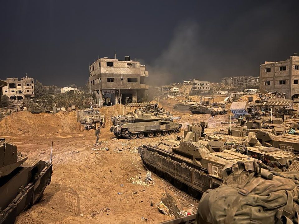
The “Netzarim Road,” located in the middle of the corridor, divides the Gaza Strip in half. The two settlement outposts have been built along this road, which aims to enable the Israeli army to control the movement of Palestinians from the south to the north and conduct operations in different parts of the Gaza Strip, according to the Israeli newspaper’s report.
According to Haaretz, the two settlement outposts are located at the intersection of the Netzarim Road, with one outpost located at the junction of Netzarim and Salah al-Din roads, and the other at the intersection of the coastal road in Gaza.
The newspaper states that hundreds of thousands of Palestinians fled through the area from the northern to the southern part of the Gaza Strip during the initial stages of the war.
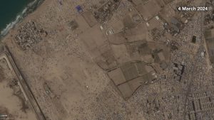
The process of building the two settlements is evident in the satellite images taken at different times during the war by the company Planet Labs, which specializes in remote sensing data collection and imaging of the Earth using satellites.
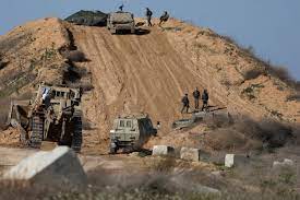
According to the newspaper, the images show that “Netzarim” has been paved to become an extension of the existing road. The land has also been prepared for the establishment of the settlements, and the army subsequently moved its equipment to the site.
The Israeli occupation established the Netzarim settlement in 1977, located 5 kilometers from the city of Gaza, with an estimated area of 2,325 dunams (one dunam is equal to one thousand square meters). The total area that the occupation controlled to secure the settlements was about 4,300 dunams. On August 15, 2005, the Israeli army began evacuating the settlers.
According to Haaretz, the images also show air-conditioned housing units brought to the site, infrastructure for electricity, toilets, and bathrooms. The phrase “Welcome to Netzarim Base” was written on a concrete barrier at the settlement outposts along the coastal road.
Haaretz added that the Netzarim Corridor, currently under Israeli control, is among the negotiation points between Tel Aviv and the Islamic Resistance Movement (Hamas), which demands the withdrawal of the Israeli army from it and the settlement outposts built on it.
On the other hand, the Israeli army considers the construction of the corridor and its control over it as an achievement realized through its war on Gaza and intends to continue its occupation of the site for a long period of time, which Hamas does not accept, according to the newspaper.
In two video clips taken from a distance not far from the Salah al-Din road site, Israeli soldiers can be seen singing and dancing.